Clearcutting in California Watersheds:
Loss of Biodiversity of Wildlife and Native Plants
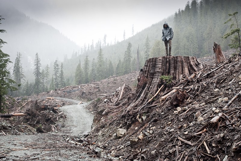
Forests of huge pines, firs and cedars covered the watersheds of the Northstate until the mid-1800s. Post-Gold Rush and into the early 1900s, the old original growth giants of the forests which were roughly 500 years old, fell to saws and were replaced with young 2nd growth forests.
The industrial timberlands of 2nd growth trees, 80 to 100 years old in the northern and central Sierra Nevada, the Trinities, and the Siskiyous, began being heavily clearcut in the 1990s.
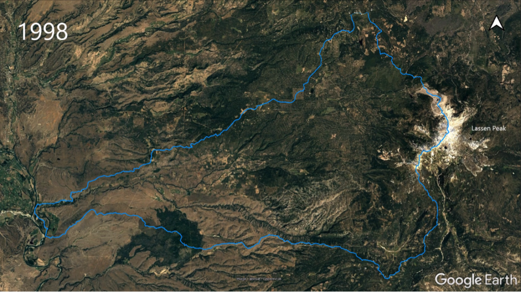
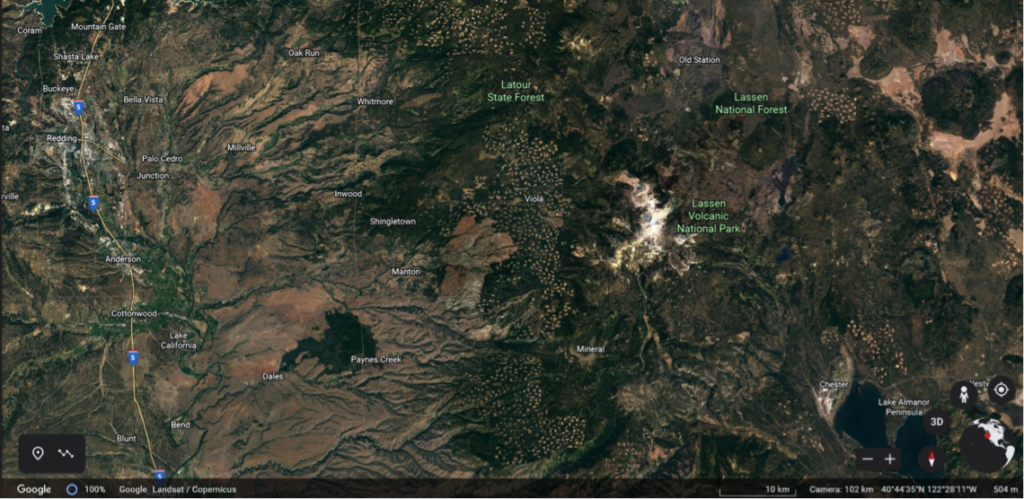
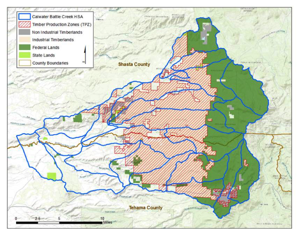
The Battle Creek watershed, which lies in both Shasta and Tehama counties, begins on the west side of Lassen Forest and ends near I-5 between Redding and Red Bluff. It is one example of the clearcutting and salvage logging destruction which has occurred in California’s precious forests. Below are Google Earth images of the watershed in 1998 and 2020 that illustrate how much logging has occurred during drought and climate change. The blue line outlines Battle Creek watershed which consists of over 222,000 acres; 34% is industrial timberland.
Downstream of the industrial timberland, Battle Creek is home to one of the largest Chinook salmon and steelhead restoration projects in the country. Currently over $164 million have been spent on the project. Steelhead and spring-run Chinook are listed as “Threatened” and winter-run Chinook are listed as “Endangered” under the Endangered Species Act.
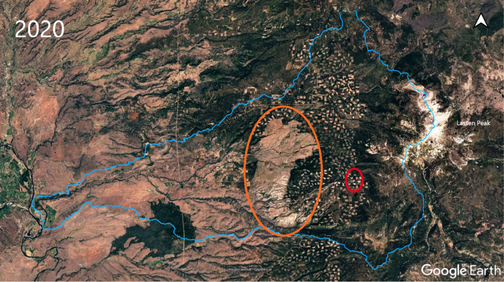
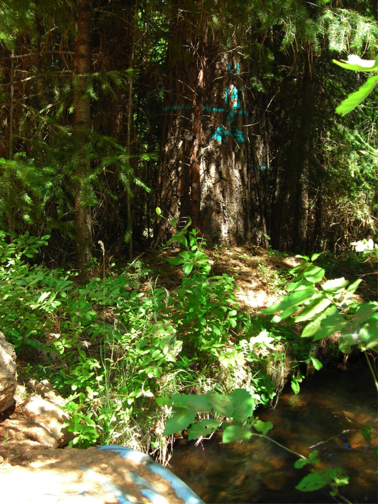
Each unit is ~20 acres, equivalent to 4 square city blocks.
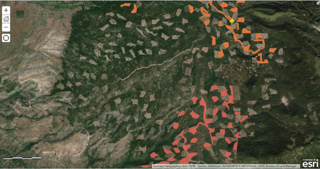
Cal Fire is the agency which approves logging plans. According to their records, 67 logging plans covering over 61,000 acres have been filed in the industrial timberland block of the Battle Creek watershed between 1997 and 2016. The 61,000 acres of plans do not include additional acres logged under post-fire salvage and other types of exemptions. Two more logging plans were filed in 2019 and 2020 which would cut 2,000 more acres, which are situated between clearcuts from earlier plans. We have filed lawsuits to stop these plans due to the ongoing cumulative impacts from past logging. Climate, fire behavior, water quality, wildlife habitat, and native plants are just some of the irreplaceable natural resources and issues that are being endlessly assaulted and affected by the lack of understanding of ecology by the public agencies charged with protection of state lands.
Decades of logging activities and road operations in the upper part of Battle Creek watershed has contributed to significant climate, water quality and wildlife habitat impacts downstream in the watershed. Despite substantial evidence of these ongoing cumulative impacts, the plans we are suing over never acknowledge the existing degradation of the Battle Creek watershed, or the potential for the addition of the plans to make things worse. In order to justify ignoring these impacts, Cal Fire followed its long-term standard practice of only addressing potential cumulative impacts associated with a single logging plan that are discernable within a smaller, limited “planning” watershed in which the plan is located, and refusing to address downstream watercourses where relevant cumulative impacts are or would be present.
This practice masked both the plan’s cumulative impacts, as it has done for numerous other logging plans in Battle Creek. In fact, Cal Fire’s practice is so effective at masking cumulative impacts that it has never found one cumulative watershed impact in Battle Creek, despite undisputed evidence of their existence.
Unfortunately, neither the Rio Gatito or Powerhouse plan is unique. Cal Fire has a pattern and practice of accepting the same type of factually void logging plans throughout the Battle Creek watershed as well as other watersheds, never providing the public or decision makers with the information necessary to knowledgably assess the cumulative environmental impacts of each logging plan.