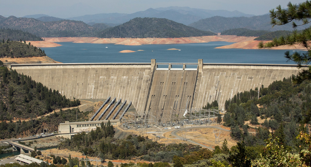
View of Shasta Dam
Photo credit: Dan Brekke
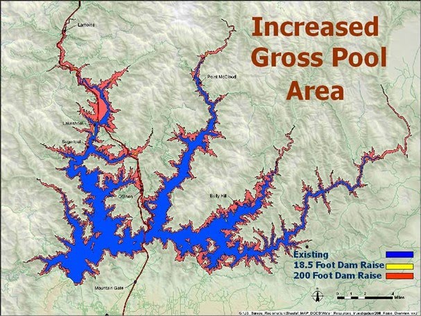
The Bureau of Reclamation projects a 13% increase in water storage from the proposed dam raise, but that same expansion would permanently inundate over 2,500 acres of National Recreation Area lands, dozens of recreational facilities, and an estimated 200 private parcels.
While the debate over the proposed 18.5-foot dam raise focuses on water storage gains, the map below tells a different story: campgrounds, boat ramps, marinas, roads, and forests that would disappear beneath the expanded reservoir, and the recreational economy with them.
The map below shows Shasta Lake and surrounding areas with proposed and current water levels.
How to use this map
- Click the ⓘ information icon (top left of the map) to open the legend and bookmarks. Use the bookmarks (ribbon symbol) to jump to specific areas of the lake like Bridge Bay, Lakehead, and the McCloud arm.
- Zoom in to the shoreline to see the real impact. The three lake level zones become clear at close range:
- Existing Full Pool (light blue) — the current lake boundary at maximum capacity
- 18.5 ft. Raise (+634,000 AF) (teal) — how far the water would extend under the proposed dam raise
- Displacement Zone (pink) — land beyond the new waterline that would be acquired or condemned, including roads, campgrounds, and private property
- Click on features to see details including name, managing agency, and elevation.
Map Detail
Key Areas Affected
Screenshots below highlight specific zones where recreational infrastructure falls within the proposed inundation boundary.
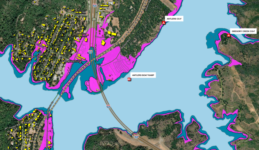
Lakeshore Community
Approximately 200 non-federal parcels fall within the proposed inundation zone, concentrated around the Lakeshore community.
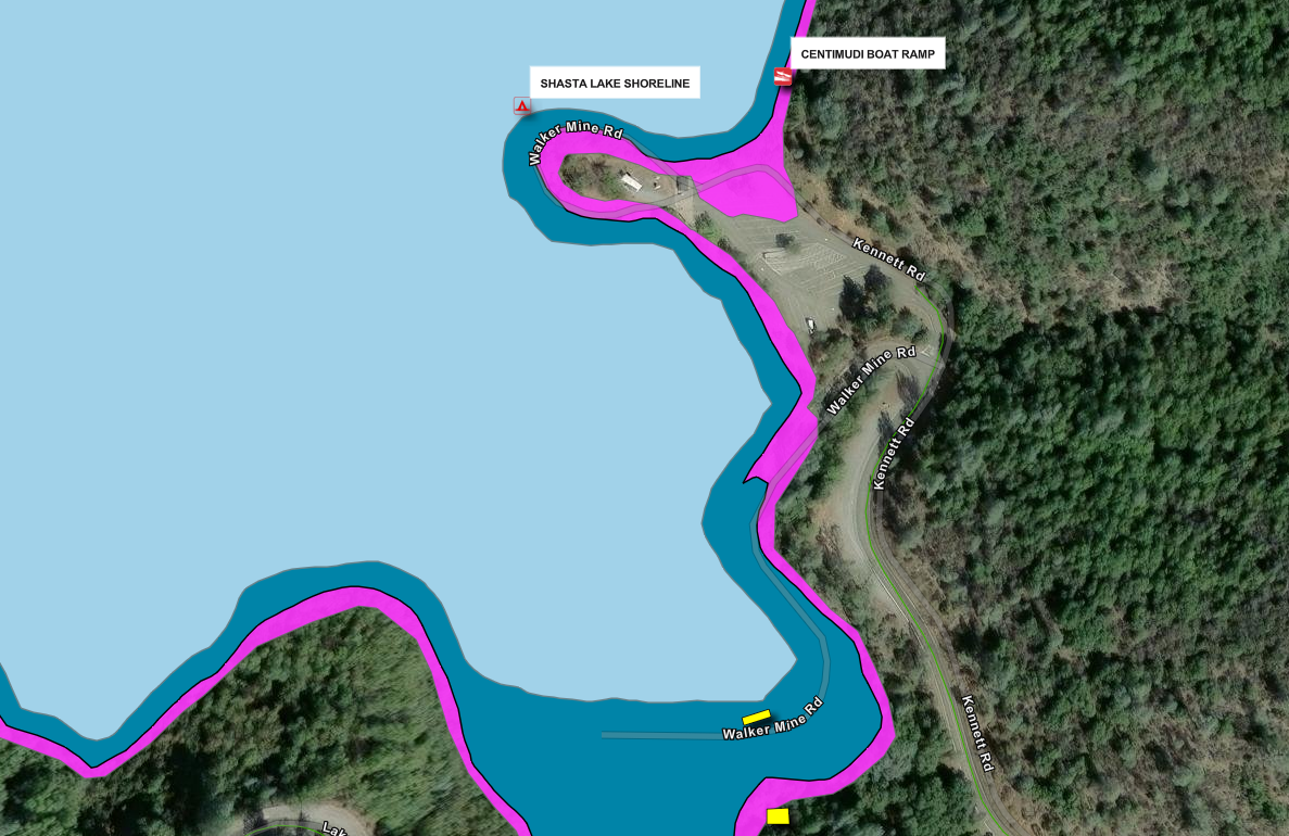
Recreation Facilities
Dozens of campgrounds, boat ramps, and marina facilities fall within the new inundation zone and would require relocation or permanent closure.
2,500 +
ADDITIONAL ACRES UNDERWATER
200+
PRIVATE PARCELS SEIZED
6 MILES +
ROADS AND BRIDGES RELOCATED
The following fact sheet, compiled from Bureau of Reclamation documents, environmental impact statements, and public records, details the full scope of the proposed Shasta Dam and Reservoir Enlargement Project.
Raising Shasta Dam: The Facts
Shasta Dam sits at the top of the Sacramento River just north of Redding, holding back California’s largest reservoir. The water it stores serves a wide range of users: farmers and cities along the Sacramento Valley, the Anderson-Cottonwood Irrigation District, the City of Redding, and communities much further south as water flows down the river and eventually gets pumped out of the Delta all the way to the San Joaquin Valley and Bay Area. It also plays a key role in flood control for the entire Sacramento Valley and helps maintain cold water flows that salmon depend on downstream.
The federal government has proposed raising the dam by 18.5 feet, which would expand storage capacity by about 13%. Supporters say it would improve water reliability and boost cold water releases to help threatened salmon. But after years of study, the Bureau of Reclamation’s own final report declined to recommend moving forward, citing unresolved legal, environmental, and financial obstacles.
The water gain is also smaller than it sounds. All that construction, all those displaced families and businesses, all that flooded forest and recreation land, and the end result is an average increase of 51,300 acre-feet per year, roughly one tenth of one percent of what California uses annually.
Costs and Cost-Sharers
Cost and Benefits — In 2015, raising Shasta Dam by 18.5 feet was estimated to cost nearly $1.4 billion in 2014 dollars. The Bureau of Reclamation’s current estimate is $2 billion, and Friends of the River puts the real number at $2 to $4 billion once inflation and construction cost increases are factored in. Under rules that took effect in 2025, taxpayers are now potentially on the hook for the entire construction cost with no repayment required from anyone.
Water Yield — The 18.5-foot raise will increase the reservoir’s capacity by 634,000 acre-feet, but the average increased deliveries provided by the enlarged reservoir are only 51,300 acre-feet, or a little more than 1/10th of 1% of the state’s annual water budget. The Bureau of Reclamation admits that hydrology, climate change, water system operations, water supply reliability, and water demand are all “significant uncertainties” regarding the actual water yield.
Water Contracts — No specific water buyers have been officially named, but most of the additional supply is expected to be sold to large agricultural water contractors south of the Sacramento-San Joaquin Delta. Agricultural water contractors in the San Joaquin Valley pay as little as $22 per acre-foot for water delivered through federally built infrastructure. Southern California cities pay $800 per acre-foot for the same water. Farming, recreation, and tribal losses happen here in the North State, while the subsidized water benefit gets pumped hundreds of miles south to large Central Valley farming operations.
To put the water revenue in perspective: applying the statewide average of 80% agricultural and 20% urban water use to the 51,300 acre-feet of new water, total annual water sales revenue would be roughly $9.1 million per year. Against $2 to $4 billion in construction costs, it would take between 220 and 440 years for water sales revenue to equal the cost of building the project.
Non-Federal Cost-Sharing Partners — Federal law previously required that at least 50% of the project cost be paid by a non-federal partner. No partner ever stepped up. California courts blocked Westlands Water District from participating, effectively killing the project under the old rules.
Then the rules changed. In 2025, Congress eliminated both the repayment requirement and the cost share requirement that had applied to federal water storage projects for more than a century. Under the new rules, taxpayer money for water storage is not paid back by anyone, and no local partner is required to match it.
That single change transformed this project. Water districts now get publicly funded infrastructure at zero cost to themselves, then sell the water from it to farms at $22 per acre-foot while Southern California cities pay $800 per acre-foot for the same water. Taxpayers pay to build it. Water districts acquire the new water supply for free. Farms buy it at a fraction of market rate. Nobody pays the construction cost back. Ever.
The $40 million just announced for Shasta planning comes under those new rules. Taxpayers have now spent at least $68 million on planning for a project that has never broken ground, with a construction cost estimated at $2 to $4 billion, none of it ever repaid.
The 18.5-foot raise will increase the reservoir’s capacity by 634,000 acre-feet, but the average increase is only 51,300 acre-feet, or about 1/10th of 1% of the state’s annual water budget.
Significant & Unavoidable Impacts
The federal government’s own environmental review found these impacts significant, unavoidable, and impossible to fully fix:
- Salmon and Steelhead — The dam raise is partly justified as a benefit to endangered fish, but the U.S. Fish and Wildlife Service pushed back hard on that claim. They found the benefit to salmon downstream of Red Bluff to be not “substantial,” and said it “only provides minimal benefit” for the spring and winter run chinook salmon that need it most.
- Winnemem Wintu Sacred Sites — When Shasta Dam was first built, it flooded 90% of the Winnemem Wintu tribe’s ancestral homeland. The sites that remain above water are still actively used for ceremonies and burials. Raising the dam would drown them too. The Bureau’s own review acknowledged the impacts on the tribe would be “disproportionally high.”
- Recreation Land — More than 2,600 acres of the Whiskeytown-Shasta-Trinity National Recreation Area would be permanently submerged. That is public land managed specifically for outdoor recreation and conservation.
- Protected Rivers — The expanded reservoir would flood sections of the McCloud River that are legally protected under California’s Wild and Scenic Rivers Act. That protection exists precisely to prevent this.
- Wildlife and Rare Plants — Deer habitat, sensitive wildlife species, and several rare plant populations found nowhere else on earth would be permanently lost under the new waterline.
- Downstream Effects — The impacts do not stop at the reservoir’s edge. Reduced freshwater flows would affect the Sacramento River National Wildlife Refuge and travel all the way to the Sacramento-San Joaquin Delta, increasing mortality for already endangered fish species.
Attempted WIIN Authorization
In January 2018, the federal government announced it had made a formal decision to begin construction under a federal law called the Water Infrastructure Improvements for the Nation Act, known as WIIN. The announcement did not mention that the project conflicts with state law, even though the Bureau of Reclamation’s own environmental review had already acknowledged that conflict.
WIIN requires that at least half the project cost come from a non-federal partner, and that all applicable laws including state law be followed. Congressional leaders tried to strip out the cost-sharing requirement and secure $20 million in pre-construction funding. California’s Natural Resources Secretary opposed the funding on the grounds that the project violates the state’s Wild and Scenic Rivers Act. The cost-share waiver failed, but the $20 million in design funding went through anyway.
That pattern has continued and accelerated. In 2025, Congress eliminated both the repayment requirement and the cost share requirement that had applied to federal water storage projects for more than a century. Under the new rules, taxpayer money for water storage is not paid back by anyone, and no local partner is required to match it. In March 2026, the federal government announced $40 million from that pool for Shasta planning and preconstruction activities. Taxpayers have now spent at least $68 million on planning for a project that has never broken ground. The legal conflicts with California’s Wild and Scenic Rivers Act remain completely unresolved.
Lawsuits
California did not just oppose the dam raise politically. It went to court.
In May 2019, California’s Attorney General and a coalition of fishing and conservation groups filed separate lawsuits against Westlands Water District in Shasta County Superior Court, arguing that as a state agency Westlands was legally prohibited from helping plan or fund any project that would harm the McCloud River. Westlands tried to move the case to Fresno County and failed. That July the court granted a preliminary injunction blocking Westlands from continuing its environmental review or signing any cost-sharing agreement. Westlands appealed all the way to the California Supreme Court. Every appeal was rejected.
With no legal path forward, Westlands settled the lawsuits in late 2019, agreeing it would not prepare environmental documents, fund the dam raise, or acquire land to support it if doing so would violate California’s Wild and Scenic Rivers Act.
That knocked out the federal government’s most likely cost-share partner. The Bureau of Reclamation’s response was to say the court ruling did not apply to them and proceed anyway. Then in 2025, Congress eliminated the cost share and repayment requirements altogether, effectively removing the financial barrier that the settlement had created.
The legal barrier under California’s Wild and Scenic Rivers Act remains in place. The project is still prohibited under state law. The federal government’s position is that it can proceed anyway. That standoff is where things remain today.
The proposed increases
More Information
For current fact sheets and resources: Friends of the River — Sacramento Threat: Shasta
Contact your state and federal representatives and ask them how they reconcile their support for this project considering the above facts.